Sensor Types
Meeting the challenges of today with the technologies of tomorrow.

How do modular sensors work?
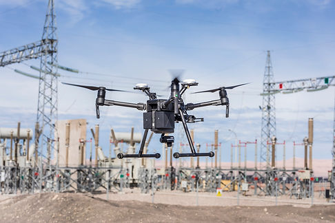
Some drones have built-in cameras that are very useful for videography/photogrammetry. For more advanced data collection we frequently use modular multispectral, thermal, or LiDAR sensors mounted on a UAV to collect data. With recent advances in UAS technology we can also offer more specialized services like hyper-spectral or gas detection sensors.
Thermography
What is thermal imaging?
Drones are the best way to createa detailed thermal model of alarge area or facility
We collect thousands oftemperature readings from the flight and compile them to createa detailed thermal ma
What can thermal imaging be used for?
-
Rooftop inspections
-
Powerline inspections
-
Search and Rescue
-
Pre-Emergency Baseline
-
Solar panel inspections


What is multispectral imaging?
-
Our multispectral imaging consists of five wavelengths; blue, green, red, red edge, near infrared (NIR)
-
Using a Normalized Difference Vegetation Index (NDVI) multispectral data is used to identify the species and health of plants over large areas
What can multispectral imaging be used for?
-
Tracking plant life in a body of water or coastlines
-
Identifying, counting, and locating invasive species of plants
-
Monitoring plant growth for forest management or agriculture
Multispectral Imagery
LiDAR sensors mounted on a UAV canbe flown slower and closer to thesurface than a plane, resulting indenser and more accurate pointclouds.
What is LiDAR?
-
LiDAR functions by sending out thousands oflaser beams per second and measuring the timeit takes for the lasers to return from the surface
-
LiDAR imaging creates dense 3-D point cloudsthat can render high-quality terrain contour lines
-
LiDAR remains accurate regardless of difficultweather conditions, ambient lighting, or plantfoliage
What can LiDAR do?
-
Shoreline mapping
-
Topographies of areas covered in vegetation
-
Land mapping
-
Digital Elevation Models (DEM)
-
Assessing crop conditions
-
Flood modeling

LiDAR

Videography & Photogrammetry
-
By flying in multiple pre-plotted patterns above an object, we can stitch the thousands of photos together to create a detailed orthomosaic of an area or object. This photogrammetry has many applications
-
Photogrammetry can be used to create detailed 3D models of any of your buildings, for insurance inspections, or promotional reasons.
-
With the proper flight and data processing, photogrammetry can generate detailed Digital Surface Models (DSMs).
-
Videography can be used to livestream/record any event or object for promotional purposes.
